Tour de France 2027 route: all 21 stages
The short answer
The 2027 Tour de France runs from Edinburgh to Paris, 2–25 July 2027: 21 stages over 3,479 km. The organisers count 7 flat, 6 hilly and 6 mountain stages and 2 individual time trials (71 km against the clock), with summit finishes on the Grand Colombier, at Les Saisies and on the Col du Portet.
The 114th Tour de France starts in Edinburgh on Friday 2 July 2027 and spends its first three days in Scotland, England and Wales before crossing to Normandy. It finishes on the Champs-Élysées on Sunday 25 July. The organisers presented the route on 22 October 2026. Every stage below is as letour.fr publishes it, checked against two cycling outlets, with our own maps and ten years of July weather at every start and finish.
 Great BritainEdinburghCardiffCherbourg-en-CotentinCherbourgParis · finishParisLes SaisiesCol du Portet123456789101112131415161718192021
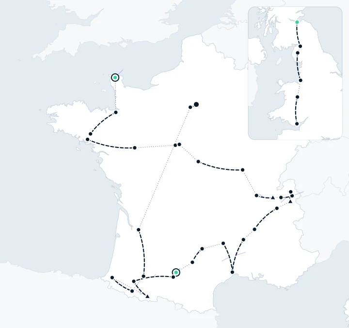
- Start to finish (not the road)
- Transfer
- Summit finish
Each dashed line joins a stage’s start and finish; it isn’t the road the race takes. Dotted lines are transfers between stages. Triangles: the three summit finishes. Inset: the three stages in Great Britain, before the transfer to France.
Map: livedot, drawn from the stage towns on letour.fr. Land: Natural Earth (public domain).
The 2027 route at a glance
- 21 stages, 3,479 km (before homologation, so the figures can still move slightly) and 53,450 m of climbing.
- 7 flat, 6 hilly and 6 mountain stages and 2 individual time trials, by the organisers' count (there's a note on stage 6 under the table).
- Three summit finishes: the Grand Colombier (stage 9), Les Saisies (stage 11) and the Col du Portet (stage 18). At 2,215 m, the Col du Portet is the highest point of the race.
- 71 km against the clock, the most since 2012: 38 km from Blois to Chambord (stage 7) and 33 km in Toulouse (stage 16).
- Three rest days: Monday 5 July in Cherbourg-en-Cotentin, Monday 12 July in Haute-Savoie and Monday 19 July in Toulouse.
- The mountains come in this order, as the organisers put it: the Massif Central, the Jura, the Alps and the Pyrenees.
- Bonus seconds of 10, 6 and 4 for the first three at the finish of every road stage, and an intermediate sprint on every road stage.
- 38 stage towns, nine of them new to the Tour: Edinburgh, Carlisle, Keswick, Liverpool, Welshpool, Cardiff, Pontorson, Les Saisies and Hasparren. In France the race visits 9 regions and 31 departments.
- The 28th Grand Départ outside France, and the third in Great Britain, after London in 2007 and Yorkshire in 2014.
All 21 stages of the 2027 Tour de France
Tap a stage for its map, its numbers and its usual weather.
| Stage | Date | Start → finish | Distance | Type | Climbing |
|---|---|---|---|---|---|
| 1 | Fri 2 Jul | Edinburgh to Carlisle | 185 km | Flat | 2,000 m |
| 2 | Sat 3 Jul | Keswick to Liverpool | 223 km | Hilly | 3,000 m |
| 3 | Sun 4 Jul | Welshpool to Cardiff | 223 km | Hilly | 3,000 m |
| Rest day Mon 5 Jul · Cherbourg-en-Cotentin | |||||
| 4 | Tue 6 Jul | Cherbourg-en-Cotentin | 171 km | Hilly | 2,200 m |
| 5 | Wed 7 Jul | Pontorson to Plumelec | 178 km | Hilly | 1,900 m |
| 6 | Thu 8 Jul | Vannes to Angers | 193 km | Hilly* | 1,500 m |
| 7 | Fri 9 Jul | Blois to Chambord | 38 km | Individual time trial | 200 m |
| 8 | Sat 10 Jul | Bourges to Le Creusot | 224 km | Hilly | 3,100 m |
| 9 | Sun 11 Jul | Villars-les-Dombes Parc des Oiseaux to Grand Colombier Summit finish | 162 km | Mountain | 3,750 m |
| Rest day Mon 12 Jul · Haute-Savoie | |||||
| 10 | Tue 13 Jul | Annecy to Sallanches | 171 km | Mountain | 3,750 m |
| 11 | Wed 14 Jul | Cluses to Les Saisies Summit finish | 150 km | Mountain | 4,750 m |
| 12 | Thu 15 Jul | Chambéry to Valence | 162 km | Flat | 1,600 m |
| 13 | Fri 16 Jul | Aubenas to Montpellier | 164 km | Flat | 1,500 m |
| 14 | Sat 17 Jul | Montpellier to Mende | 199 km | Mountain | 4,300 m |
| 15 | Sun 18 Jul | Rodez to Albi | 169 km | Hilly | 2,500 m |
| Rest day Mon 19 Jul · Toulouse | |||||
| 16 | Tue 20 Jul | Toulouse | 33 km | Individual time trial | 200 m |
| 17 | Wed 21 Jul | Muret to Pau | 186 km | Flat | 2,000 m |
| 18 | Thu 22 Jul | Pau to Saint-Lary-Soulan Col du Portet Summit finish | 174 km | Mountain | 5,400 m |
| 19 | Fri 23 Jul | Hasparren to Laruns | 160 km | Mountain | 4,300 m |
| 20 | Sat 24 Jul | Maubourguet to Libourne | 198 km | Flat | 1,700 m |
| 21 | Sun 25 Jul | Saint-Quentin-en-Yvelines to Paris Champs-Élysées | 116 km | Flat | 800 m |
| Total, 21 stages | 3,479 km | 53,450 m | |||
Distances and climbing (the organisers’ D+, the total height gained) are letour.fr’s, before homologation: they can still change slightly. * letour.fr’s stage list and stage 6’s own page mark Vannes to Angers as hilly, which makes 6 flat and 7 hilly stages; its route summary counts 7 flat and 6 hilly. We show each stage as its own page labels it.
What is the weather usually like on the 2027 route?
The race heads south into the heat. In Great Britain, 15:00 was usually about 16 to 18°, with a south-westerly or westerly breeze of 16 to 18 km/h and rain on about half the days or more: 6 to 7 days in 10 at Keswick and Liverpool. By the second week the afternoons are warm to hot. Aubenas, the start of stage 13, was the hottest place on the route, about 30° at 15:00 and 30° or more on 7 days in 10, and Valence and Toulouse reached 30° on about half the days. The afternoon wind is lightest in the mountains, about 5 to 7 km/h in the Alps and at the Col du Portet, and Montpellier was the driest stop, with rain on about 1 day in 10.
Each stage below has its own numbers. For a single ride rather than a whole Tour, see how race-day weather works with ChatGPT or Claude.
Week one: Edinburgh to the Grand Colombier (stages 1–9)
Stage 1: Edinburgh to Carlisle
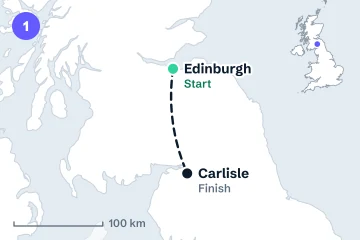
Friday 2 July. The race opens in Scotland's capital and crosses into England to finish in Carlisle, 185 km away: a flat stage by the organisers' reckoning, with 2,000 m of climbing. Both towns are new to the Tour, and the first yellow jersey of 2027 is decided here.
- Date
- Friday 2 July
- Distance
- 185 km
- Type
- Flat
- Climbing
- 2,000 m
- Finish
- Not a summit finish
Stage 2: Keswick to Liverpool
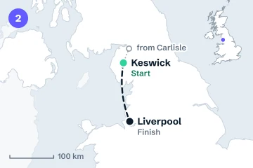
Saturday 3 July. From Keswick, in the Lake District, to Liverpool: 223 km, one of the longest days of the race, classed as hilly, with 3,000 m of climbing. Both are first-time stage towns.
- Date
- Saturday 3 July
- Distance
- 223 km
- Type
- Hilly
- Climbing
- 3,000 m
- Finish
- Not a summit finish
Stage 3: Welshpool to Cardiff
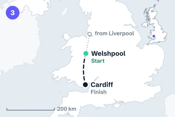
Sunday 4 July. A Welsh day, also 223 km and hilly with 3,000 m of climbing, from Welshpool to the capital, Cardiff. Then the race leaves Great Britain: Monday 5 July is the first rest day, in Cherbourg-en-Cotentin.
- Date
- Sunday 4 July
- Distance
- 223 km
- Type
- Hilly
- Climbing
- 3,000 m
- Finish
- Not a summit finish
Stage 4: Cherbourg-en-Cotentin
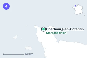
Tuesday 6 July. The first stage in France starts and finishes in Cherbourg-en-Cotentin, on the Cotentin peninsula in Normandy: 171 km, hilly, with 2,200 m of climbing.
- Date
- Tuesday 6 July
- Distance
- 171 km
- Type
- Hilly
- Climbing
- 2,200 m
- Finish
- Where it started
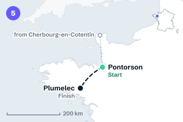
Stage 5: Pontorson to Plumelec
Wednesday 7 July. From Pontorson, in Normandy and new to the Tour, into Brittany to finish in Plumelec: 178 km, hilly, with 1,900 m of climbing.
- Date
- Wednesday 7 July
- Distance
- 178 km
- Type
- Hilly
- Climbing
- 1,900 m
- Finish
- Not a summit finish
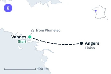
Stage 6: Vannes to Angers
Thursday 8 July. East from Vannes, in Brittany, to Angers on the Loire side: 193 km with 1,500 m of climbing, the least of any road stage in the first week. letour.fr's stage pages call it hilly, though its summary counts one more flat stage and one fewer hilly stage than those pages add up to (see the note under the table).
- Date
- Thursday 8 July
- Distance
- 193 km
- Type
- Hilly
- Climbing
- 1,500 m
- Finish
- Not a summit finish
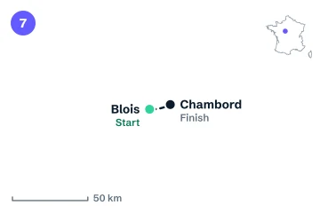
Stage 7: Blois to Chambord, individual time trial
Friday 9 July. The first of the two time trials: 38 km on your own from Blois to Chambord, in the Loire Valley, with just 200 m of climbing. It's the longer of the two.
- Date
- Friday 9 July
- Distance
- 38 km
- Type
- Individual time trial
- Climbing
- 200 m
- Finish
- Not a summit finish
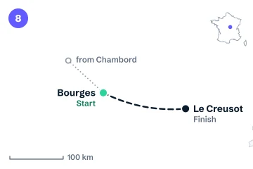
Stage 8: Bourges to Le Creusot
Saturday 10 July. At 224 km, from Bourges to Le Creusot, the longest stage of the race: hilly, with 3,100 m of climbing.
- Date
- Saturday 10 July
- Distance
- 224 km
- Type
- Hilly
- Climbing
- 3,100 m
- Finish
- Not a summit finish
Stage 9: Villars-les-Dombes Parc des Oiseaux to the Grand Colombier
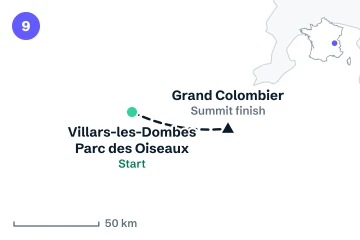
Sunday 11 July. The first mountain stage and the first summit finish: 162 km from the Parc des Oiseaux at Villars-les-Dombes to the top of the Grand Colombier, in the Jura, with 3,750 m of climbing. Monday 12 July is the second rest day, in Haute-Savoie.
- Date
- Sunday 11 July
- Distance
- 162 km
- Type
- Mountain
- Climbing
- 3,750 m
- Finish
- Summit finish
The finish is a summit: the records describe its grid square, so the top itself is usually cooler.
Week two: the Alps to Albi (stages 10–15)
Stage 10: Annecy to Sallanches
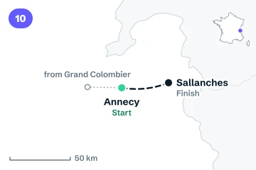
Tuesday 13 July. Into the Alps, from Annecy to Sallanches: 171 km, a mountain stage with 3,750 m of climbing, finishing in the valley town rather than on a summit.
- Date
- Tuesday 13 July
- Distance
- 171 km
- Type
- Mountain
- Climbing
- 3,750 m
- Finish
- Not a summit finish
Stage 11: Cluses to Les Saisies
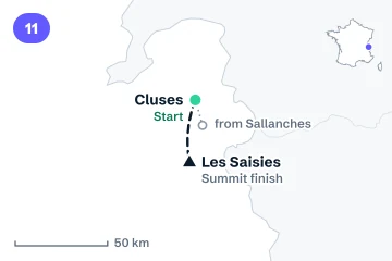
Wednesday 14 July, France's national day. The second summit finish, at Les Saisies, new to the Tour: 150 km from Cluses with 4,750 m of climbing, the second-most of any stage, packed into the shortest mountain stage.
- Date
- Wednesday 14 July
- Distance
- 150 km
- Type
- Mountain
- Climbing
- 4,750 m
- Finish
- Summit finish
The finish is a summit: the records describe its grid square, so the top itself is usually cooler.
Stage 12: Chambéry to Valence
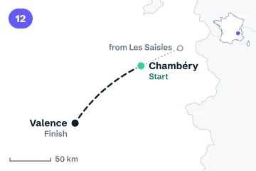
Thursday 15 July. Out of the Alps to Valence on the Rhône: 162 km, flat, with 1,600 m of climbing.
- Date
- Thursday 15 July
- Distance
- 162 km
- Type
- Flat
- Climbing
- 1,600 m
- Finish
- Not a summit finish
Stage 13: Aubenas to Montpellier
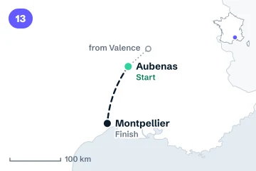
Friday 16 July. From Aubenas, in the Ardèche, to Montpellier: 164 km, flat, with 1,500 m of climbing.
- Date
- Friday 16 July
- Distance
- 164 km
- Type
- Flat
- Climbing
- 1,500 m
- Finish
- Not a summit finish
Stage 14: Montpellier to Mende
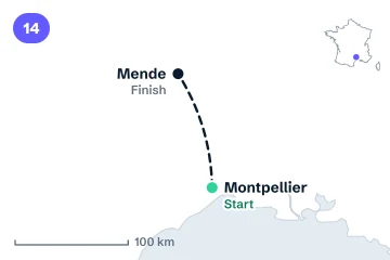
Saturday 17 July. From the Mediterranean side up to Mende, in the Lozère: 199 km, the longest of the mountain stages, with 4,300 m of climbing. It isn't one of the three summit finishes on the organisers' list.
- Date
- Saturday 17 July
- Distance
- 199 km
- Type
- Mountain
- Climbing
- 4,300 m
- Finish
- Not a summit finish
Stage 15: Rodez to Albi
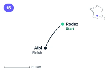
Sunday 18 July. From Rodez to Albi: 169 km, hilly, with 2,500 m of climbing. Monday 19 July is the last rest day, in Toulouse.
- Date
- Sunday 18 July
- Distance
- 169 km
- Type
- Hilly
- Climbing
- 2,500 m
- Finish
- Not a summit finish
Week three: Toulouse to Paris (stages 16–21)
Stage 16: Toulouse, individual time trial
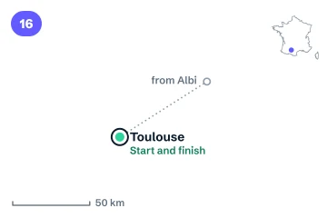
Tuesday 20 July. The second time trial, 33 km in Toulouse with 200 m of climbing, straight after the rest day there.
- Date
- Tuesday 20 July
- Distance
- 33 km
- Type
- Individual time trial
- Climbing
- 200 m
- Finish
- Where it started
Stage 17: Muret to Pau
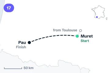
Wednesday 21 July. From Muret, just south of Toulouse, to Pau at the foot of the Pyrenees: 186 km, flat, with 2,000 m of climbing.
- Date
- Wednesday 21 July
- Distance
- 186 km
- Type
- Flat
- Climbing
- 2,000 m
- Finish
- Not a summit finish
Stage 18: Pau to Saint-Lary-Soulan Col du Portet
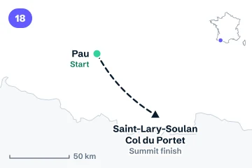
Thursday 22 July. The race's highest point and its most climbing in one day: 174 km from Pau to the summit finish on the Col du Portet, at 2,215 m above Saint-Lary-Soulan, with 5,400 m of climbing, more than any other stage.
- Date
- Thursday 22 July
- Distance
- 174 km
- Type
- Mountain
- Climbing
- 5,400 m
- Finish
- Summit finish
The finish is a summit: the records describe its grid square, so the top itself is usually cooler.
Stage 19: Hasparren to Laruns
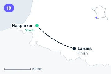
Friday 23 July. The last mountain stage, from Hasparren, in the Basque Country and new to the Tour, to Laruns: 160 km with 4,300 m of climbing.
- Date
- Friday 23 July
- Distance
- 160 km
- Type
- Mountain
- Climbing
- 4,300 m
- Finish
- Not a summit finish
Stage 20: Maubourguet to Libourne
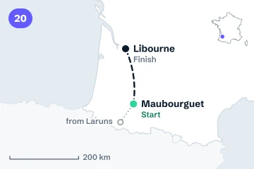
Saturday 24 July. North from Maubourguet to Libourne, in the Gironde: 198 km, flat, with 1,700 m of climbing.
- Date
- Saturday 24 July
- Distance
- 198 km
- Type
- Flat
- Climbing
- 1,700 m
- Finish
- Not a summit finish
Stage 21: Saint-Quentin-en-Yvelines to Paris Champs-Élysées
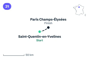
Sunday 25 July. The finale: 116 km from Saint-Quentin-en-Yvelines, south-west of Paris, to the Champs-Élysées, with 800 m of climbing.
- Date
- Sunday 25 July
- Distance
- 116 km
- Type
- Flat
- Climbing
- 800 m
- Finish
- Not a summit finish
Where these facts come from
Every stage's number, date, start and finish, distance, type, climbing and summit finish is from the organisers' 2027 route page and each stage's own page on letour.fr, as published on 22 October 2026, and checked against Cyclingnews and ProCyclingUK. Where they differ, we use the organisers' figure. The maps are ours, drawn from the stage towns' coordinates on Natural Earth's public-domain outlines; the lines join each start and finish and aren't the roads. The weather is Copernicus ERA5, 2015–2024. livedot isn't connected with the Tour de France or its organisers.
Following a rider on a multi-day event of your own? Here's how to follow a cyclist live on a tour or race, and the Tour Down Under 2027 weather guide for a stage race on the other side of the world.
Questions
Where does the 2027 Tour de France start?
In Edinburgh, Scotland, on Friday 2 July 2027. Stage 1 runs 185 km to Carlisle. It is the third Grand Départ in Great Britain, after London in 2007 and Yorkshire in 2014. The race then spends two more days in England and Wales before the transfer to France.
How many stages are in the 2027 Tour de France?
21 stages over 3,479 km (before homologation), with three rest days: Monday 5 July in Cherbourg-en-Cotentin, Monday 12 July in Haute-Savoie and Monday 19 July in Toulouse. The organisers' summary counts 7 flat, 6 hilly and 6 mountain stages and 2 individual time trials.
How many time-trial kilometres are in the 2027 Tour de France?
71 km, in two individual time trials: 38 km from Blois to Chambord on stage 7 (Friday 9 July) and 33 km in Toulouse on stage 16 (Tuesday 20 July). The organisers say it's the most time trialling since 2012.
How many summit finishes are in the 2027 Tour de France?
Three: the Grand Colombier on stage 9 (Sunday 11 July), Les Saisies on stage 11 (Wednesday 14 July) and Saint-Lary-Soulan Col du Portet on stage 18 (Thursday 22 July). At 2,215 m, the Col du Portet is the highest point of the 2027 race.
When does the 2027 Tour de France finish in Paris?
On Sunday 25 July 2027. Stage 21 runs 116 km from Saint-Quentin-en-Yvelines to the Champs-Élysées.
What is the weather usually like during the 2027 Tour de France?
In ten years of Copernicus ERA5 records around each stage's date, mid-afternoon was coolest in Great Britain, about 16 to 18° at 15:00, and hottest in the south: about 30° at Aubenas, the start of stage 13, where the day reached 30° or more on 7 days in 10. Rain fell on 6 to 7 days in 10 at Keswick and Liverpool, and on about 1 in 10 at Montpellier. That's history, not a forecast.